Miami University GIS students shed light on history, support Ohio communities
The Ohio Capital Journal highlights Robbyn Abbitt’s students’ work on the first comprehensive map of land in Ohio stolen from the Randolph Freedpeople
Miami University GIS students shed light on history, support Ohio communities
The Ohio Capital Journal highlights Robbyn Abbitt’s students’ work on the first comprehensive map of land in Ohio stolen from the Randolph Freedpeople
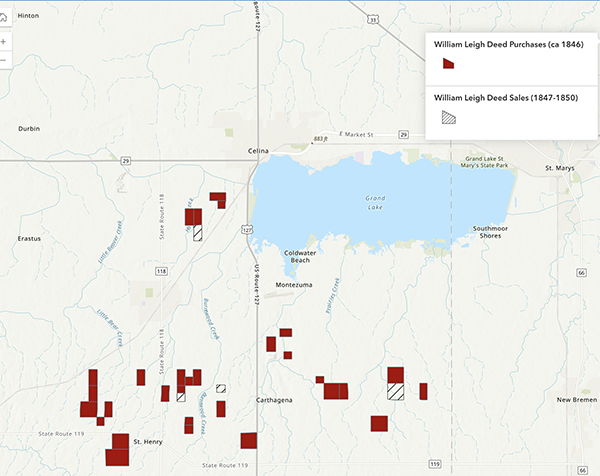
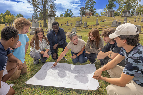
Abbitt’s students combed through Mercer County property records to create the first comprehensive map of the land purchased for the Randolph Freedpeople.
They identified 3,140 of the 3,200 acres purchased on behalf of the Randolph Freedpeople, from nearly 200 parcels that sit near Carthagena, mostly south or southwest of Grand Lake St. Marys.
"Despite the many challenges the Randolph Freedpeople faced, their story remains significant, as demonstrated by the continued efforts of their descendants to reclaim land and preserve their heritage. This project helps us understand their unique history and reminds us of the ongoing impacts of slavery, land ownership, and racial inequality in American history," wrote the students on the project website.
Read part two of Evans’ series: “Ohio lawmakers wrestle with how to make amends for land denied the Randolph Freedpeople”
GIS students continue to support Mercer County this spring
This semester, Abbitt’s class of 27 students will continue working in Mercer county.
“Last semester's project introduced me to more people working at the County level who have GIS needs and not enough time or manpower,” Abbitt said. “The projects this semester will meet specific needs of Mercer County while also giving Miami students real-world experience while in the classroom."
Projects include:
- Mapping the history of Lake St. Mary's.
- Working with Mercer County Emergency Management Agency Office to do analyses necessary for planning and preparedness.
- Starting the process of mapping several small cemeteries.
- Working on some urban infrastructure data related to parcels, zoning, and road right-of-ways.
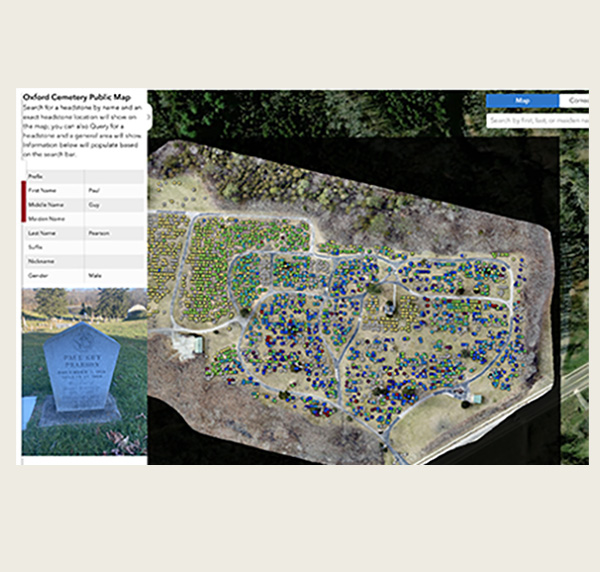
GIS students 'Connecting Past and Present' in Oxford Cemetery
A project by Abbitt’s fall 2023 and spring 2024 Advanced GIS classes on mapping the Oxford cemetery was highlighted recently in Esri's Winter ARCUser publication “Connecting Past and Present in an Ohio Cemetery.”
Esri — a global leader in geographic information system software, location intelligence, and mapping — spotlighted how the students created a public website using ArcGIS Hub, "Oxford Cemetery Digital Resources."
It includes the students’ maps, apps, and stories created with ArcGIS StoryMaps, providing details such as headstone conditions, notable gravesites, and stories of former town residents interred in the cemetery.
Now, the city of Oxford and Miami University have collaborated using ArcGIS Online so that the city can use the data collected by Abbitt and her students to actively manage and update records, according to ARCUser.
- Read more about the Oxford Cemetery project in the Miami News story Miami GIS students perform a ‘major role’ for Oxford community.